World maps can convey a wide range of information. We have developed various types of maps, which differ in the amount and type of content to be presented.
In analogue media, there is a danger of overloading world maps with too much information, so that they lose their greatest advantage – clarity. It is therefore important to define exactly what information a map is intended to provide. If there is more than one specific message, the information may be divided across several world maps or general infographics.
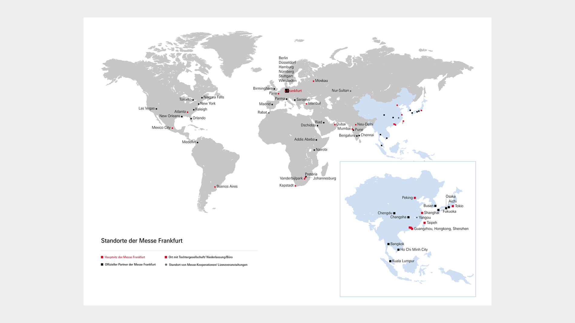
Digital media offer more possibilities to present and structure information in maps than analogue media. This is because functions such as links, magnification or mouse-over are available, for example, to accommodate additional text without overloading the map visually.
We distinguish between four types of maps:
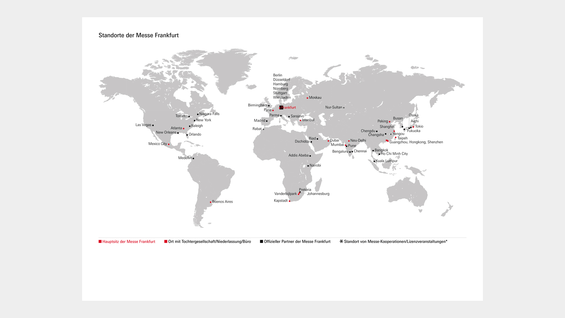
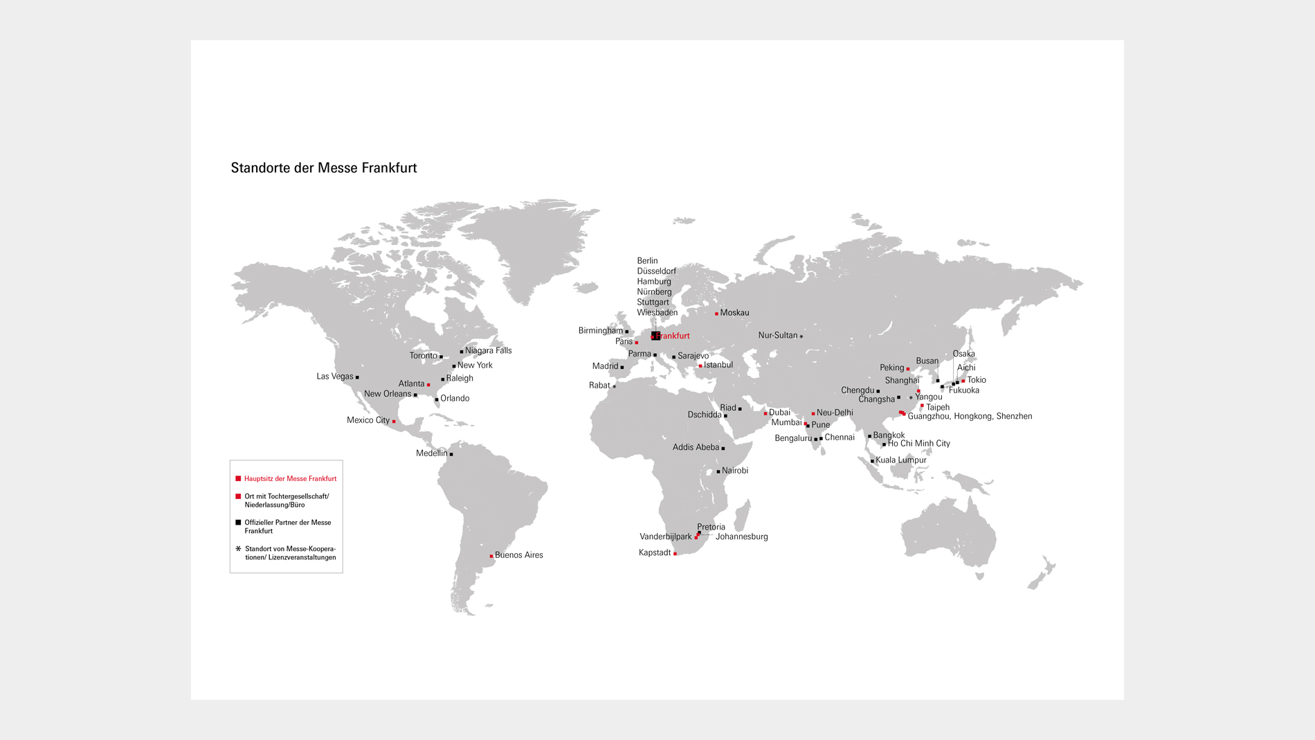
- Locations: These show locations and place names, where appropriate identified by colours and legend (e.g. locations of Messe Frankfurt with different colours for locations and subsidiaries).
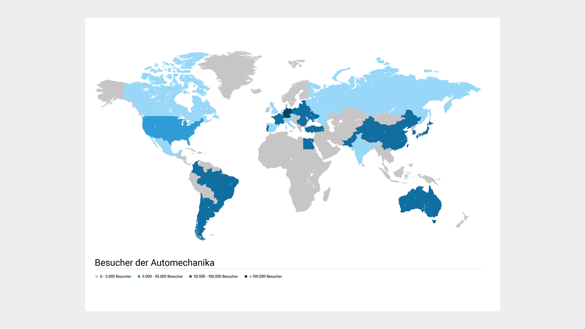
- Statistics: Certain regions/countries are coloured differently to show statistics (e.g. country of origin of trade fair visitors in 2023 with gradation of numbers).
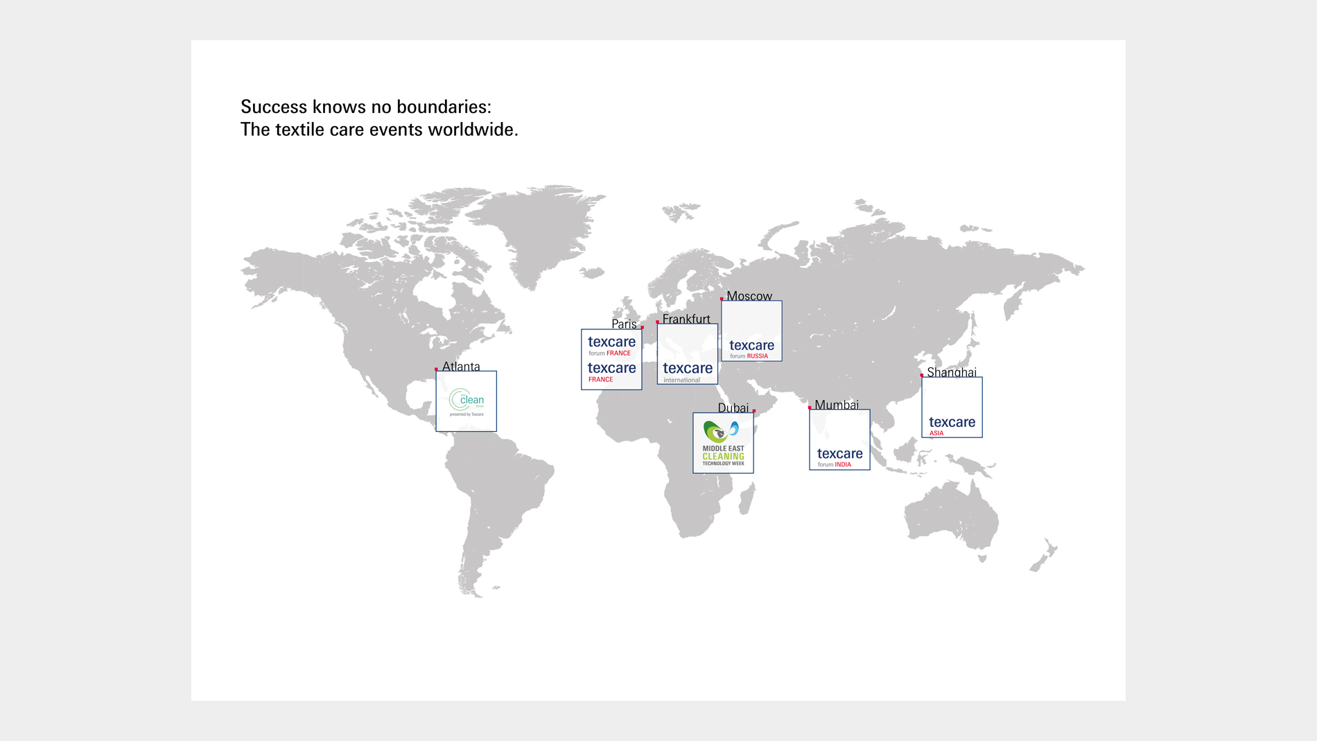
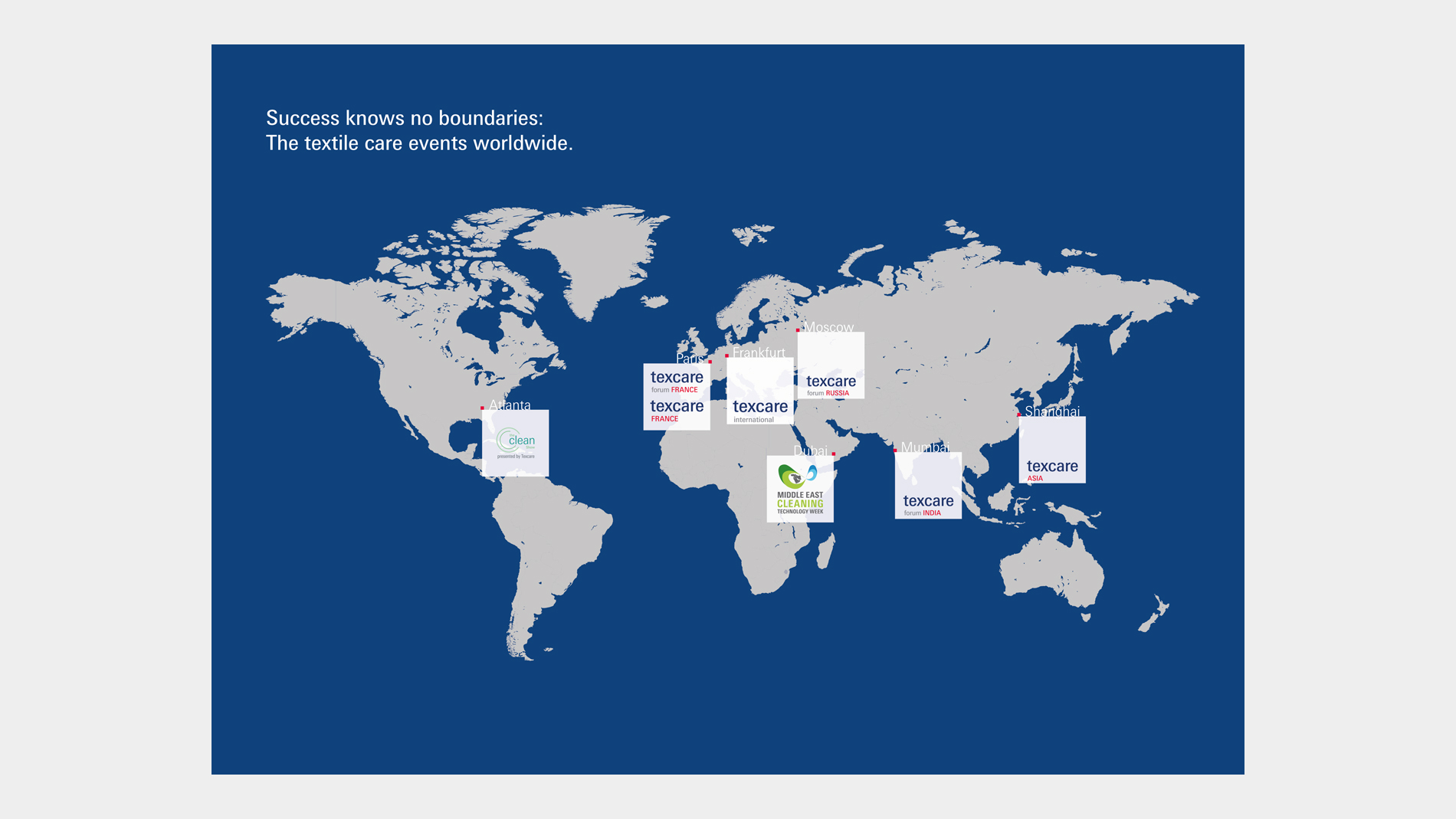
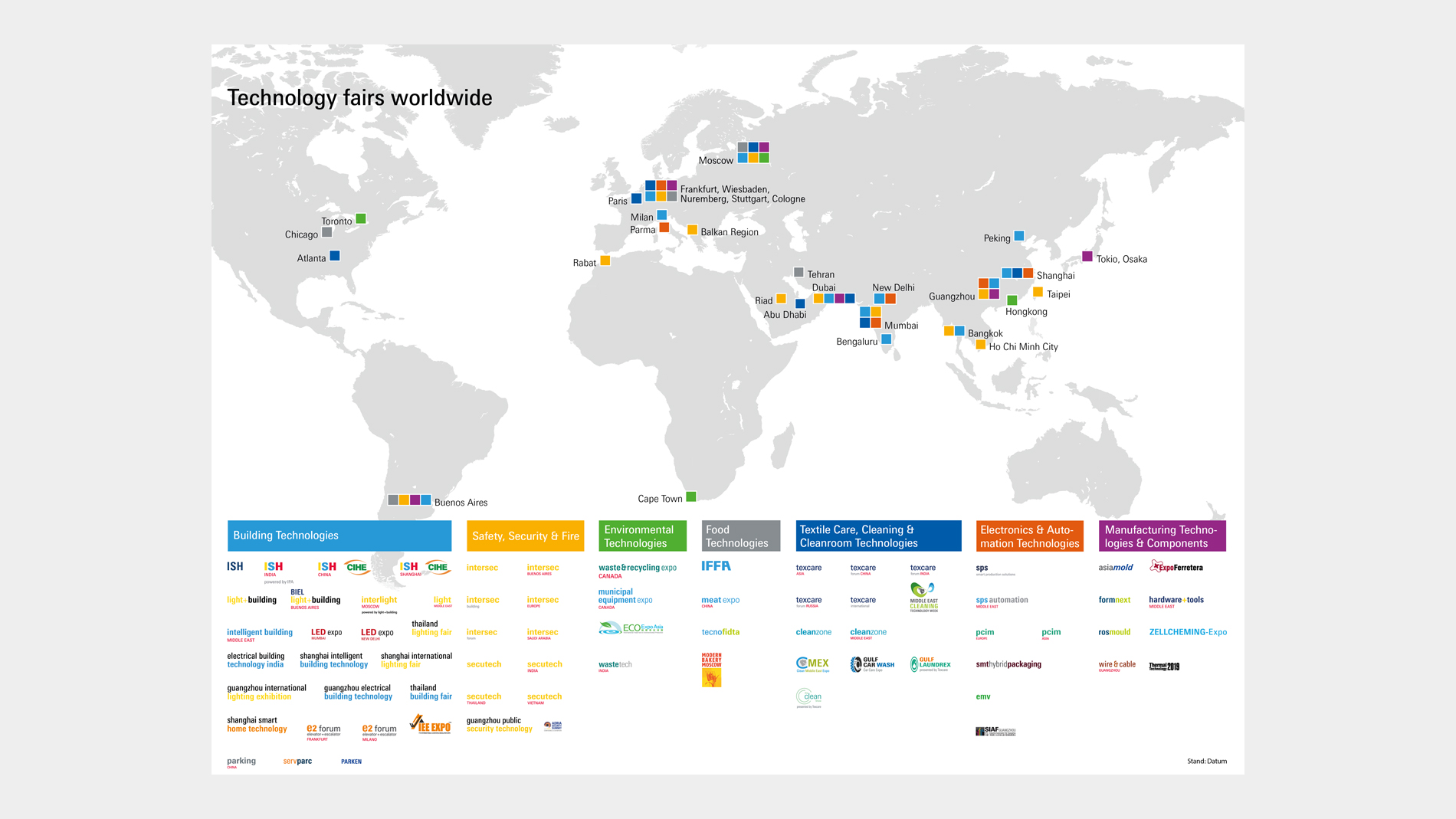
- Event venues in a specific segment: Where there are only a few events, the event logos can be placed in cubes on the map or linked to locations in a legend. Where there are many events, a legend is always required; this may contain lists as well as logos (e.g. Light+Building Technology fairs worldwide).
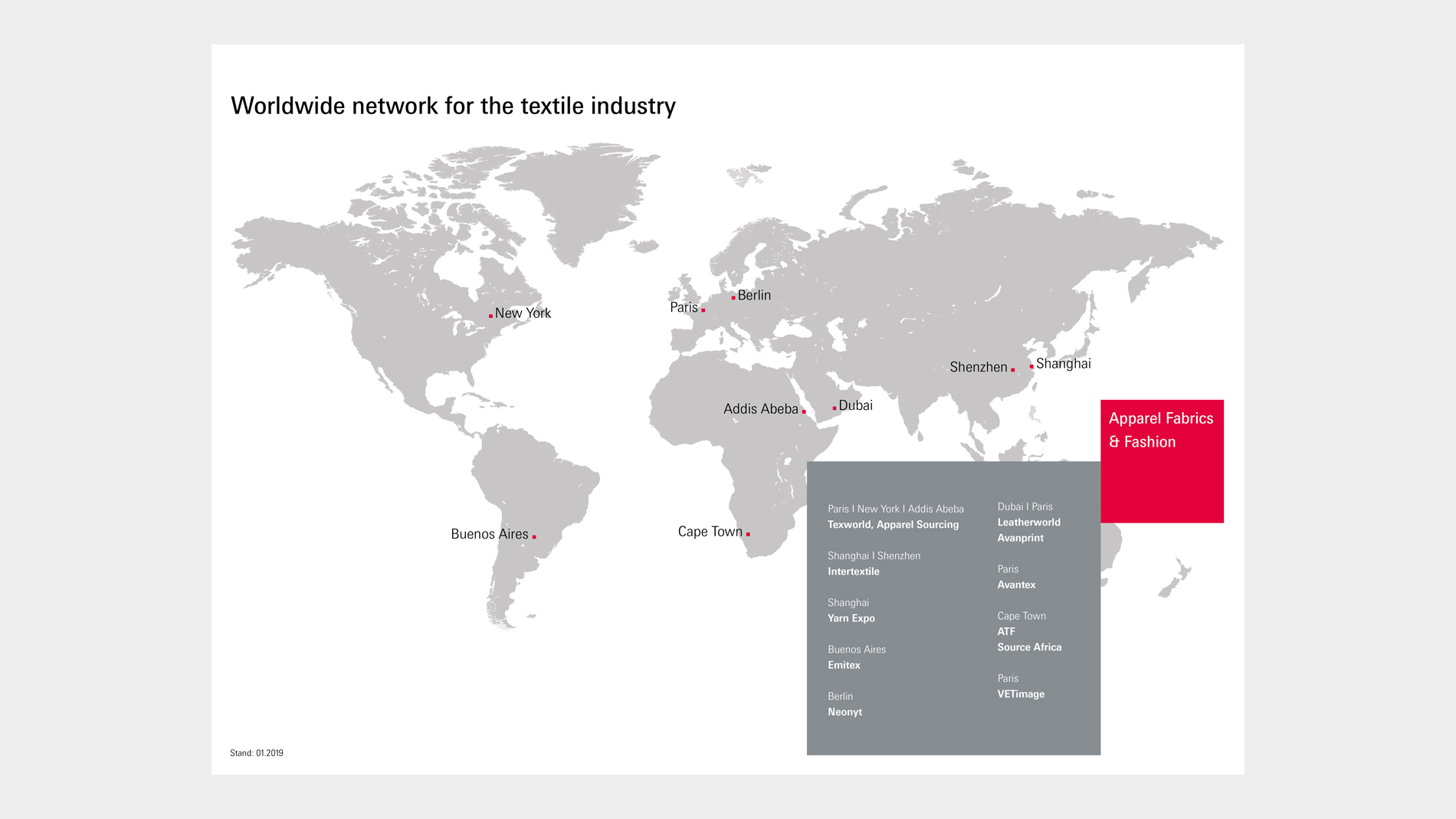
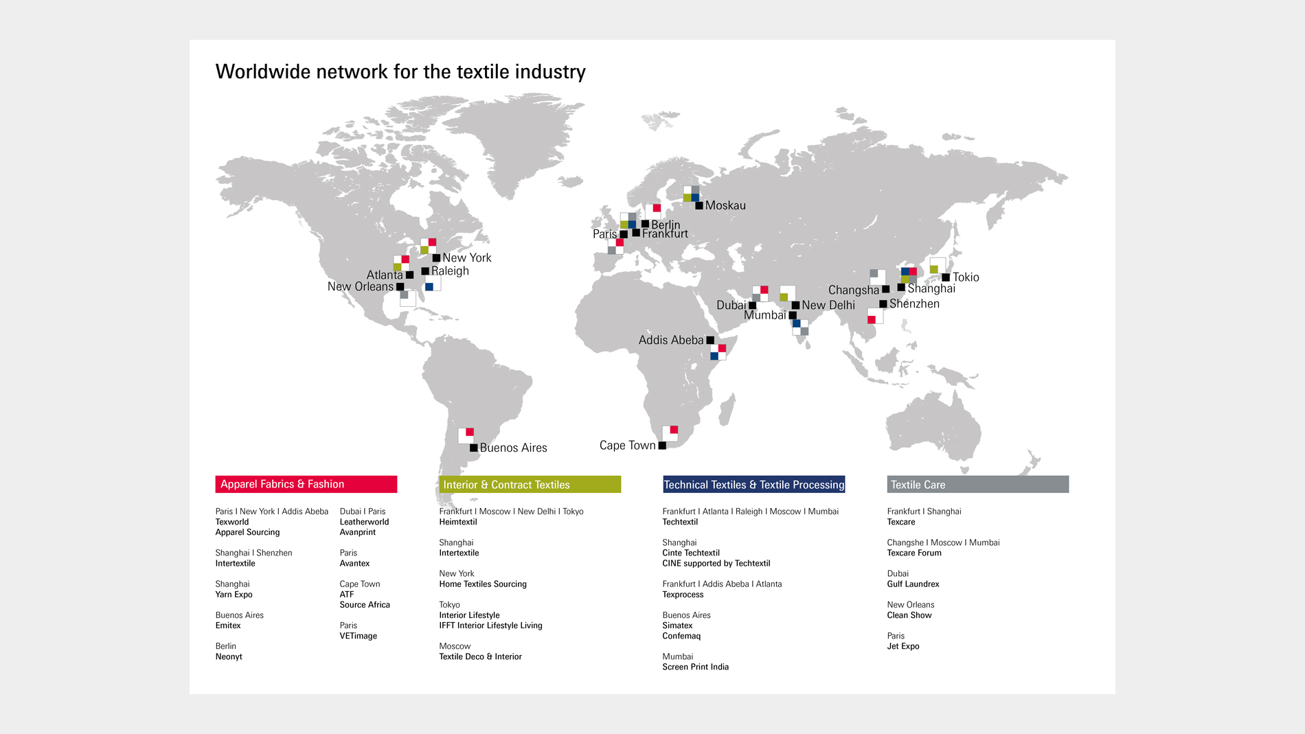
- Event venues for several segments: When showing events from one industry sector, colour coding is used to subdivide them into individual segments (e.g. Textiles fairs worldwide – subdivided into Apparel Fabrics & Fashion, Interior & Contract Textiles, Textile Care, …).
Essentials
- Message: It should be possible to summarise the information on a map in a concrete message (e.g. “All locations including subsidiaries and sales partners of Messe Frankfurt”).
- Title: World maps have a concrete message that is integrated into the map as a title. Depending on the context, the title may also be placed in an image caption.
- Legend: If the map works with different colours to indicate locations, these must be explained in a legend.
- If there are more than two logos per location, they can no longer be displayed on the map and are therefore placed in a legend.
Options
- Colour of the world map: World maps are designed in the primary and secondary corporate colours. Depending on the background, we recommend colouring the map in a Messe Frankfurt grey shade.
- Type size may vary according to the respective medium; as a guideline: for A3 we recommend a type size of 11 pt.
- Magnifier to enlarge individual areas of the map